Zambia
 |
|
|
Updated as per personal comunication with Robert Minetti, (Adafroptilum kalamboensis, Micragone ansorgei moxicoensis, Buneopsis annabellae, Nudaurelia macrothyris,
Pseudobunaea callista)January 26, 2009 Updated as per personal communication with Dave Rolfe (E. manowensis, Mbala), March 2009 Updated as per Saturnafrica #8, 2011, Philippe Darge; January 31, 2014 Updated as per Saturnafrica #11, April 2012, Philippe Darge; August 20, 2014 |
 |
The terrain of Zambia is mostly high plateau, with some hills and mountains. The lowest point is the Zambezi river, at 329 meters above sea level, with the highest being an unnamed point in the Mafinga Hills, at 2,301 meters above sea level.
Nine ecoregions in four biomes are represented in Zambia, the most widespread being Miombo, Mopane and Baikiaea woodland savanna, with grasslands (mainly flooded grassland) and evergreen forest also present.
Goto Main Index

|
 Support this website and visit other insect sites by clicking flashing butterfly links to left or right. |

|

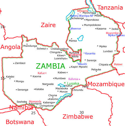
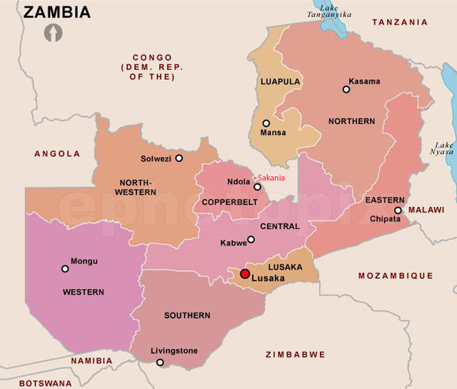
Zambia is divided into nine provinces. Below are the beginnings of very rudimentary provincial checklists for Zambia, largely based on reports from Robert Minetti.
I have greatly expanded the Copper Belt listing based on images from Sakania, Kantanga, Democratic Republic of the Congo, supplied by Nigel Voaden. Sakania s very close to the DRC/Zambia border.
Luapula | Northern |
Eastern |
Northwestern |
Copper Belt |
Central |
Western |
Southern |
Lusaka |